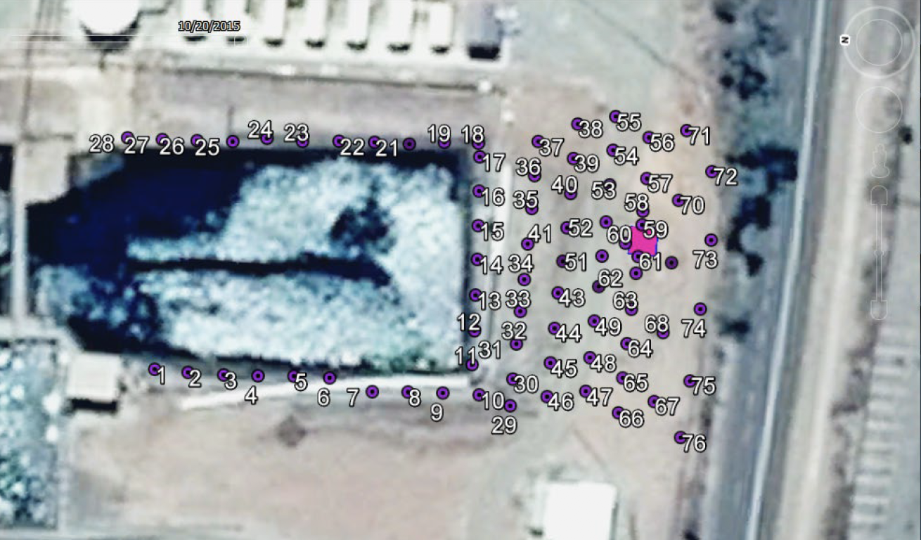
Surveying was conducted in four targeted locations in the catchment areas to support the Seismoelectric/Electrotelluric Survey of reservoir for seepage path identification. The ES survey distinguished small differences in salinity showing fresh water plumes from leaking pipes as distinct from slightly more saline groundwater.
DAM SEEPAGE PATH IDENTIFICATION FOR
A QUEENSLAND-BASED WATER BOARD,
2016
A water board appointed Geo9 to survey one of their reservoirs to identify possible areas of seepage/leakage from the pond and the buried pipelines to the south. Geo9 designed a survey surrounding the pond, producing a model processed to 30m below ground level and identified seepage paths along sidewalls and areas of preferential flow connecting leakage to the access pit. Variations in subsurface layer thickness, hydraulic properties and water content were mapped as well as intersecting fault zones which could affect the stability and integrity of the pond floor. The results will enable the client to begin a targeted maintenance and repair program.