
Geo9 is at the forefront of applying new geophysical approaches to mapping contamination plumes and contaminated flowpaths.
Our 3D projects have included mapping NAPL and hydrocarbon contamination.
Geo9 can characterise contaminated groundwater flow to inform the optimum design of monitoring, containment and remediation efforts.
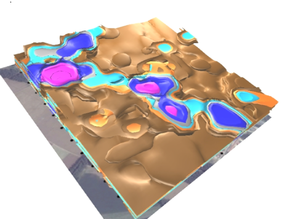
Map Contaminant Transport Pathways and Reaction Fronts
Landfill Seepage Mapping
Examples of applications include –
-
Identify ion-rich pollution plumes
-
Map landfill seepage
-
Map contaminant pathways and reaction fronts
-
Reveal areas of salt water intrusion
-
Map paleo channels