
Thrilled with the enthusiastic response to the technology from Farrer Agricultural High School students in Tamworth NSW in July 2016.
Up to 600 students will be getting their hands dirty this week to learn more about the land.
Farrer High is the first high school in Australia to commission a 3D Geo-nine aquifer map – which gives a new perspective on underground aquifer systems.
Watch the local TV news and read the Northern Daily Leader story
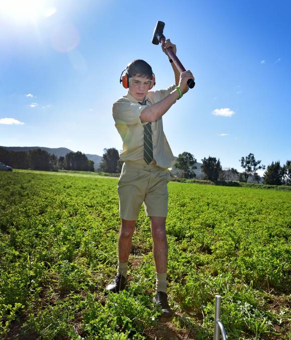
FARRER Memorial Agricultural High School students are hitting a metal plate with a sledgehammer in the name of science.
The students are conducting an aquifer mapping project on the school’s 190-hectare property, which will help them pick the best spots for new bores.
The school is the first high school in Australia to commission a 3D aquifer map, through Sydney-based groundwater explorers Geo9.
The company has a unique and world-leading scientific process, to map subsurface conditions in any location – the seismic waves created by the sledgehammer striking the metal plate travel down into the earth, generating an electrical signal that interacts with nearby water molecules.
Students find water with sledgehammer
by Jamieson Murphy
Farrar principal Clint Gallagher, said the project created a variety of learning and skills development opportunities for students.
“Our aim is to integrate the information from the groundwater study into our curriculum and train the next generation of farmers in the latest scientific groundwater study techniques,” Mr Gallagher said.