Queensland Department of Agriculture and Fisheries (DAF)
Project
Queensland Department of Agriculture and Fisheries (DAF) Survey for Flinders and Gilbert Rivers Agricultural Resource Assessment
Location
Flinders and Gilbert Rivers – Queensland, Australia
Date
25th July 2018
CHANDLER FACILITY 2015
Shallow aquifer mapping for Groundwater Assessment part of EIS for Chandler salt mine and deep underground waste storage. Seismoelectric survey results consistent with borelog and seismic data. Geo9’s full report viewable at Page 216
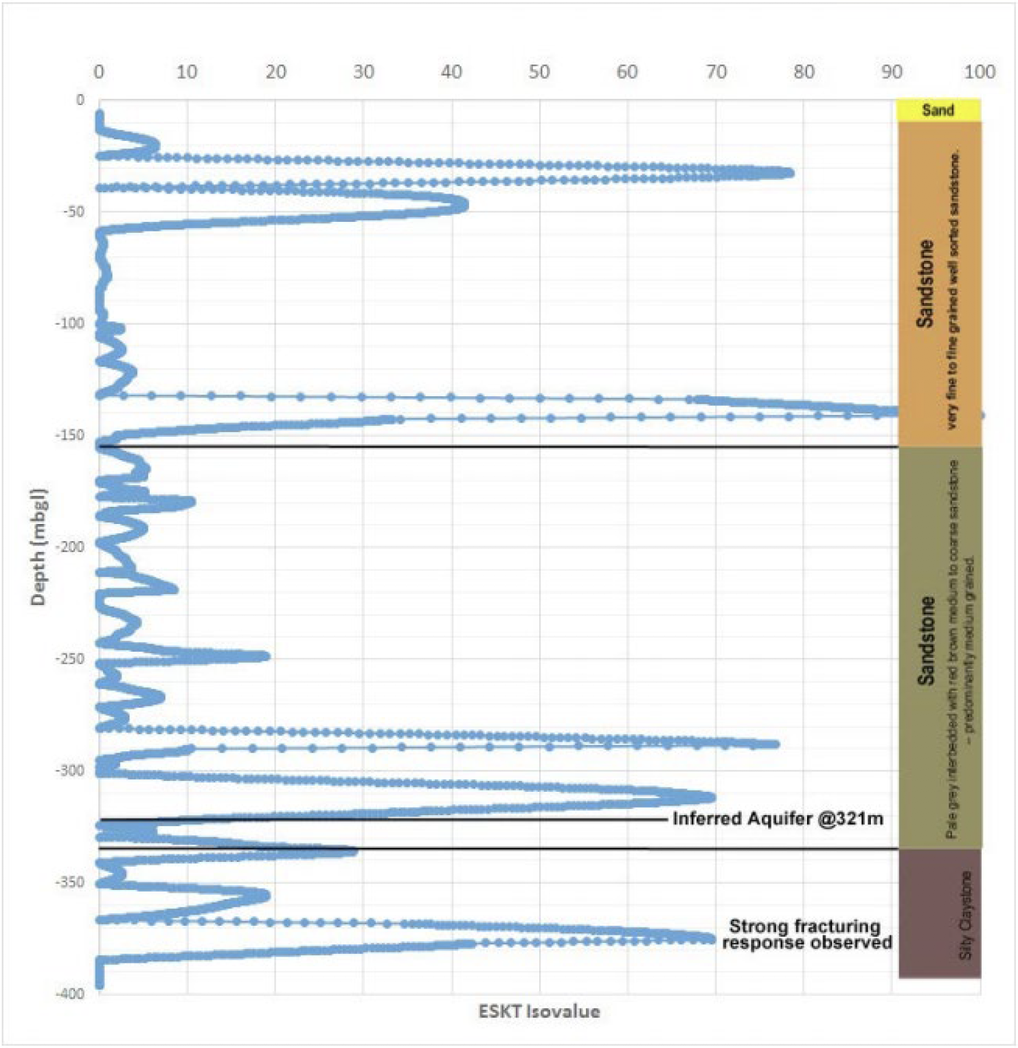
An aquifer mapping survey was undertaken by the proponent in September 2015 and the results analysed by Geo9 Pty Ltd. The dataset was used to indicatively model relative hydraulic conductivity using seismoelectric tomography. The survey was undertaken within the proposed Mine Infrastructure Area and covered a 500 metre by 500 metre footprint to a maximum depth of about 390 metres below ground level (around 400 metre above the Chandler deposit). Based on calibration with bore log data, the model results indicate there are three main aquifer zones within the saturated thickness of the sandstone aquifer, predominately between 140 and 350 metres below ground level, with minor small perched groundwater systems existing above the regional water tab le (inferred to be approximately 90 metres below ground level). The main aquifer occurrences appear to be located in discrete horizontal zones of relatively high hydraulic conductivity which occur at varying depths throughout the Lower Langra Formation.
The predicted zones of elevated hydraulic conductivity, which is a potential indicator of water within a geological unit, are depicted by the ‘spikes’ shown in Figure 1. The results of the shallow aquifer geophysical mapping correlate with bore log data. The groundwater flow potential of the Horseshoe Bend Shale Formation, Langra Formation and JayCreek Formation groundwater systems are likely to be dominated by secondary porosity as a result of the consolidated and deformed nature of the local geology (EMM 2016).
Based on the model data, Geo9 inferred that groundwater recharge does not appear to be strongly driven by local infiltration, with the majority of recharge most likely occurring remote to the site. The low hydraulic conductivity observed in shallower zones (less than 140 metres below ground level) and the depth of the piezometric surface (at about 90 metres below ground level) was interpreted to indicate that the near surface is relatively dry with little surface recharge to groundwater locally. Geo9 concluded that, given the local arid climate and lack of apparent surface recharge, groundwater in the local system is likely to be ancient.
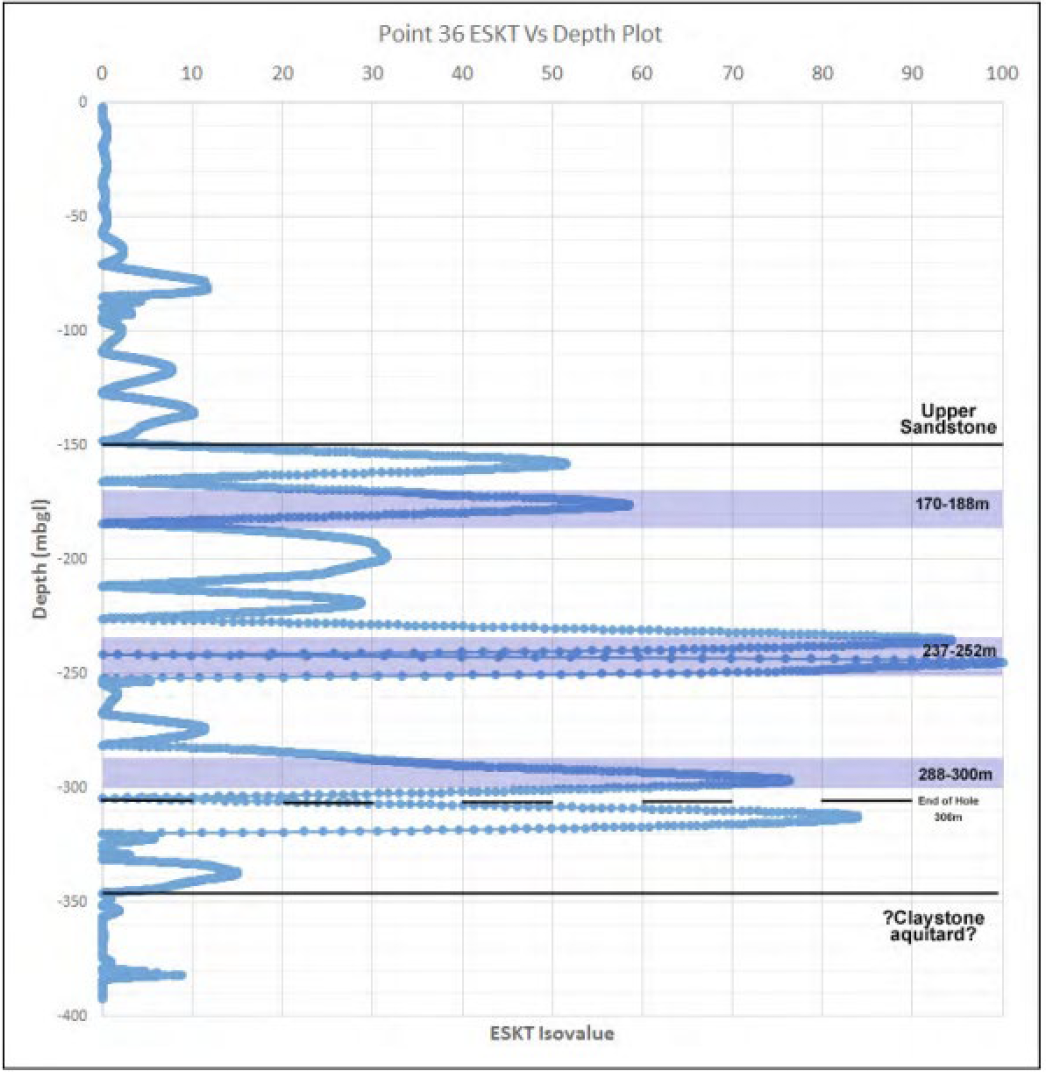
Figure 1: Seismoelectric hydraulic conductivity tomography across the Proposal area (Geo9 2015).