
Geo9 Groundwater Explorers
Geo9’s pioneering concept of “9 steps to find water” delivered hundreds of highly efficient and advanced exploration services to farmers, governments, engineering consultants and mining companies over a ten year period.
GRACE
Monitor Water from Space with GRACE
We were honoured to be a foundation partner for the commercial launch of Water Monitoring From Space in 2017, working in association with satellite gravity scientists from the German Research Centre for Geosciences.
MINERALS
Hyperspectral Mineral Analysis
We were also honoured to also be a foundation partner for the commercial launch of advanced hyperspectral mineral analytics developed at the German Research Centre for Geosciences. Our projects included satellite analyses for gold and rare earth explorers. Read our 2017 announcement here.
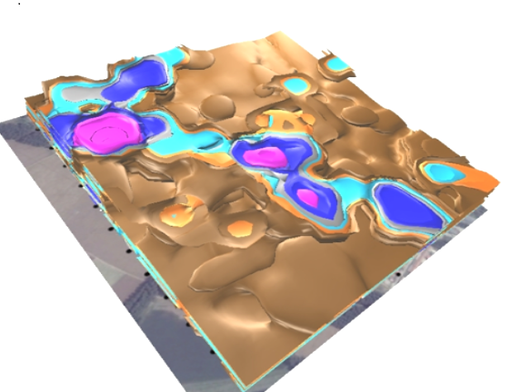
GEOTECHNICAL
Nimble 3D Mapping
Geo9 pioneered the use of 3D seismoelectric and electrotelluric geophysics for mapping dam seeps and other other geotechnical challenges. Clients included major urban utilities, engineering consultancies, mining companies and irrigators. In 2011, we were the first company to bring Willowstick technology in Australia and conduct the world’s longest dam embankment survey using that technique at the time. Geo9’s pioneering work was presented to The Australian National Committee on Large Dams conference in 2013.
CONTAMINATION